Our Rivers

Map of the Rivers
History of the Rivers and Surrounding Ozark Highlands
The clear, spring-fed waters of the Current and Jacks Fork rivers have long drawn human inhabitants to their banks. The earliest evidence of people living in the area is from the Clovis culture, with spear points from 11,000 years ago documented from sites along the Current River. There is also evidence other cultures (Dalton, Archaic, Woodland and Mississippian) lived in the area, differentiated by the types of tools they left behind. They all preceded the Osage people and written history. At the end of the Mississippian period (circa 350 years before present), the Osage were settled primarily in the western and central portions of Missouri.
In the late 1700s, French trappers were exploring southern Missouri and named the Current, La Riviere Courant or “the running river.” By the 1830s, expanding settlements by European Americans had pushed most Native Americans from Missouri and numerous tribes were forced through the region on the Trail of Tears to western territories.

In the mid-1800s, white settlements sprang up along the rivers. Grist mills were built to harness the power of water to grind corn and wheat into cornmeal and flour. Land was cleared into small farms and homes were built. Life was self-sustaining with the rich resources available along the rivers.
Missouri was in the middle of a growing America pushing west and the Ozarks had natural resources that supplied the growing nation. In the 1880s, timber and mining companies came to the region. The abundant timber resources helped fill the demand of railroads pushing west and fueled the smelters of mining companies.
By the time the Great Depression gripped America in the 1930s, much of the timber had been harvested and mining industries had pulled out of the area. With the loss of these economies, many families moved to find jobs and make a new way of life. Some families hung on during the tough years and their descendants can still be found near the Current and Jacks Fork rivers today. The harvest and production of wood products and mining continue to be important parts of the economy in the region.
The fate of the Current and Jacks Fork rivers may have been very different. After World War II, the Army Corps of Engineers proposed damming the Current River for electricity production and flood control. A grassroots effort of local conservationists, particularly the Ozark Protective Association and outdoor writers such as Leonard Hall and “Doc” Z. Lee Stokely, fought against the proposal. In early 1961, Missouri’s Conservation Commission endorsed a plan by the National Park Service to create an Ozark Rivers National Monument. It took over three years for the plan to be revised and to be signed into law, but resulted in the establishment of the Ozark National Scenic Riverways in 1964.
For more detailed information about the history of the peoples that lived in the region, visit the Osage Nation, State Historical Society of Missouri and Missouri Archaeological Society.

History of the Ozark National Scenic Riverways
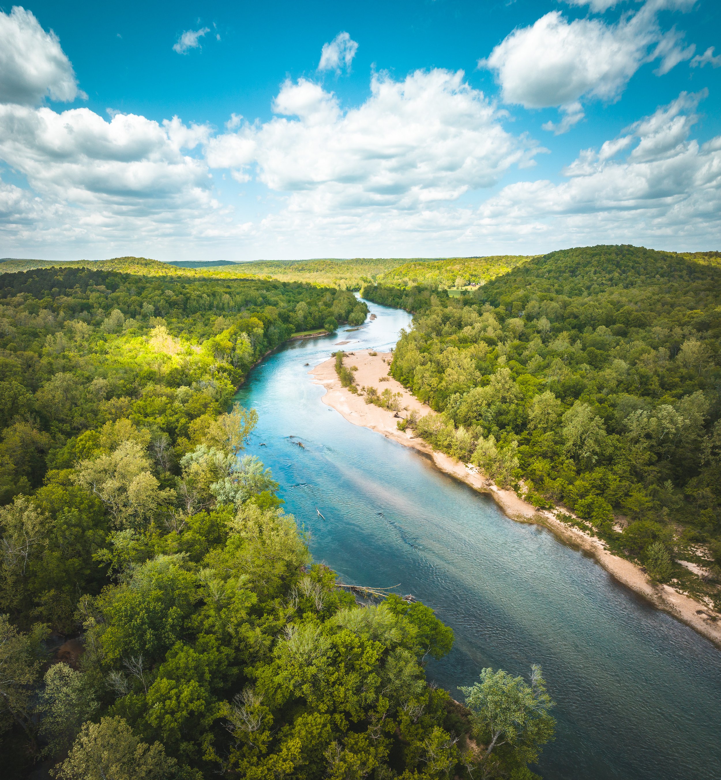
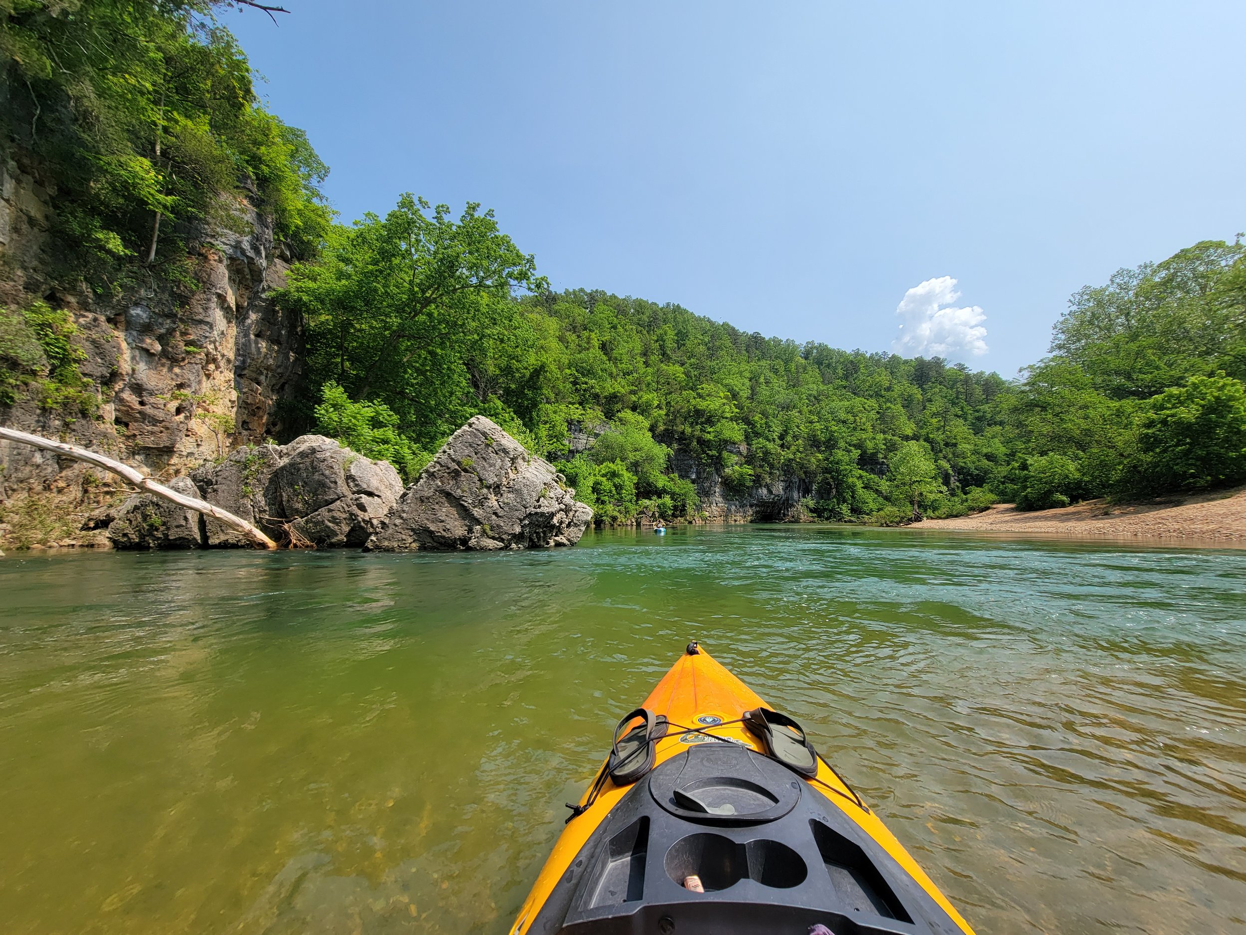
The Ozark National Scenic Riverways, a unit of the National Park Service, was created by an Act of Congress on August 27, 1964, to protect 134 Miles of the Current and Jacks Fork rivers in the Ozark Highlands of southeastern Missouri. The bill to establish the Ozark National Scenic Riverways was signed by President Lyndon B. Johnson. The Ozark National Scenic Riverways was the nation’s first “scenic riverways”- a forerunner to the 1968 Wild and Scenic Rivers Act by four years. The clean, clear waters of the spring-fed Current and Jacks Fork rivers, and the surrounding Ozark Mountains, provide excellent opportunities for many recreational activities including john boating, canoeing, kayaking, tubing, swimming, fishing, hiking, horseback riding, camping and bird watching. Hunting is also allowed within the Riverway’s boundaries, except for around developed areas. In the Ozark National Scenic Riverways you can stargaze in some of the darkest skies within Missouri and the United States. The landscape is rural, with beautiful oak-pine mixed forests covering the Ozark Highlands once again, with occasional open fields.
The Current and Jacks Fork rivers today draw roughly a million visitors a year to their banks who enjoy a variety of recreational activities. Besides these two famous rivers, the Park is home to hundreds of freshwater springs, caves, trails, unique fauna and flora, and historic sites such as Alley Mill.